


Intrepid trio, including long-term Bangkok residents Tom Ellefsen and Chris Schulz, are enchanted by the majesty and beauty of the continent’s tallest range of mountains during their seven-day ascent
In 1848, the German missionary Johan Rebmann was the first European to record snow in Africa’s tropics when he sighted Mt. Kilimanjaro. The following year, his colleague Johann Lewis Krapf sighted Mt. Kenya. In 1875, Henry Morton Stanley, in southern Uganda during his transcontinental expedition, saw “a faint view of an enormous blue mass afar off”. In the minds of many historians, there is no doubt that Stanley was looking at the Rwenzori, characteristically blanketed in cloud. While adventurer travelers understandably target Africa’s two highest peaks – Tanzania’s Mt. Kilimanjaro 6541m, and Kenya’s Mt. Kenya, 5744m – the continent’s tallest range of mountains are to be found in the Rwenzori, which includes the third highest peak: the Margherita Peak at 5109m.
Located in the southwest of Uganda’s border with the Democratic Republic of the Congo, these mountains are usually concealed in dense mist.
Bangkok- based retired UK diplomat Lem Morgan, an enthusiast trekker, encouraged long-term Bangkok residents Tom Ellefsen and Chris Schulz to explore this “off the beaten track” UNESCO World Heritage-listed National Park.
Equipped with an entrance permit, guided by experienced local guides, and supported by a few porters, the 10-day trek into the wilderness started at the entrance gate of the Rwenzori National Park at 1200m elevation. The first three days of daily 100m elevation gains led from dense equatorial jungle, containing Blue Monkeys and noisy birds, to thick bamboo and coniferous forests. At higher altitudes, heath moss forests and grasslands above 3500m elevation became predominant.

Reaching the day’s campsite after the scheduled 7-9 hours of trekking, an additional extra 200-300m elevation gain (1 hour up – 1 hour down) was added on the way up in order to help acclimatize, following the principle of “sleep overnight at a lower location”. This extra effort helped to minimize the impact of higher altitudes.
While every person reacts differently, and the more muscular type is not necessarily impacted less, 3000m is regarded as a benchmark from where acute altitude sickness (AMS) can start to show, causing lack of sleep, loss of appetite, or headaches. Once impacted, there is only one cure: Down to lower altitude as soon as possible. July daytime temperatures in the mid-twenties Celsius provided a pleasant hiking environment while the dryer air triggered very regular drink stops. This became even more important on the steep ups and downs once elevation mark 4000m was reached. The Bumwanjara Pass at 4500m revealed another deep valley featuring dark blue lakes, black swamps, dense vegetation, and exquisite health-moss woods with a wild confusion of entangled timber completely blanketed with mosses and ferns.
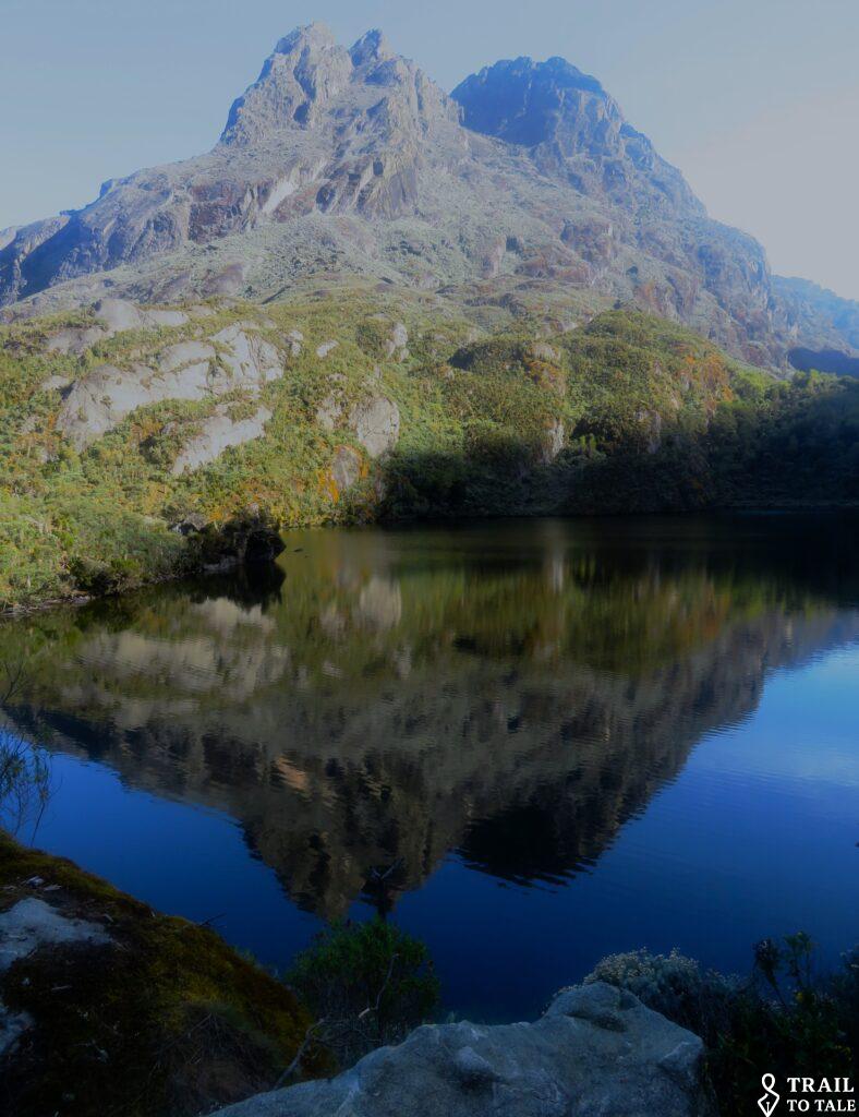
The dominant colors were greens, golds, and bronzes with only here and there some bright contrasting color provided by the rosy disa orchids, pink or red balsams, and purple cardamines having an almost mystical effect on the environment and those who intrude. For the black, muddy areas, called bogs, trekking boots had to be replaced by high rubber boots.
A rare encounter with a Red Duiker, a small antelope with a bright rufous coat and a black band running up its muzzle, provided welcome evidence of wildlife in the remote land. The only other mammal noted was the Hyrax, a thick-furred rodent-like animal weighing between two and five kgs, their remarkable toes allowing them to run up vertical surfaces and trees. Hyrax live in dens below the rocks and are seldom seen in the daytime but often make their presence heard during night with their whistling and shrieking.

Hunwick’s Camp (3974m), reached on Day 4, consisted of tent-like sleeping cabins and a wooden hut for meals, which included, in the morning, eggs and toast as well as porridge (bringing back memories of the hostel food during boarding school days in the 60s in Swakopmund, Southwest Africa). The last three hours of the day were used to learn some very basic mountaineering skills like rope and jumar handling and getting accustomed to the safely harness essential for abseiling.


Day 5 started before 5am, requiring additional warm clothing and flashlights for the initial 300m climb. Only when the sun punched through clouds a good hour later and started to illuminate the nearby peaks was the beauty of the mountains evident. Any signs of a path had disappeared and it was the pure knowledge of the guides (one for each of us) that provided direction over the smaller mossy rocks and the bigger boulders.
At some locations, wooden ladders installed earlier helped us to master the rock walls. Once we reached the steep section, helmets and harness were put on. The dry weather helped during the almost vertical passages where ropes were required to ‘juma up”. Being relative seasoned trekkers (and long-distance trail runners), traversing the narrow passages with a deep vertical drop below and a steep wall above was a new experience.


Reaching the top of Mt. Baker at 4845m, after a six-hour climb, we were rewarded with a 360-degree view that include the peaks of Weismann (4621m), Margherita (5109m) and Mt. Speke (4890m), as well as the distant steeps of Uganda and the jungle of the DRC.

With no wind, the prepared summit snack consisting of some hard cheese, chocolate, and biscuits tasted even better as we enjoyed the impressive panorama. The return to the camp rounded off an active 13-hour day.

Completing 8km with an elevation gain of 600m to reach Base Camp at 4546m after six hours made Day 5 something of a “rest day”. Enjoying the warm late afternoon sun in pristine surroundings along the Afro-alpine vegetation was a real treat.

The clear blue evening sky with no wind and sparkling stars shortly after sunset was particularly welcome while trying to get some rest for the midnight wakeup call.
Assisted by headlights, Day 7 started under a star-studded sky at 1am. However, this was very soon spoilt by snowfall which not only impacted visibility but also made the rocks and boulders slippery and icy. Equipped with helmets, safety harnesses, ice picks, crampons, and connected with ropes, we ascended and entered a world of serried ice-rime terraces like frozen ocean breakers.
During the crossing of two snow fields, dependency on our guides, a tight grip on the rope, and the use of ice pick was crucial. On the very icy sections, total trust in the crampons was required.
The combination of mist and periodic ongoing snowfall meant only a full rope’s length ahead could be seen. It took overall 10 hours to navigate our way up including a few very narrow cliffs, lined with rime ice architecture, together with some ups and downs to finally reach Margherita Peak, at 5109m the third highest elevation in Africa.

Here the snow had stopped. However, the mist reduced the faint hope of obtaining a view as visibility was reduced to 20m. The original plan to continue on the opposite side of the peak down 150m and to advance at least another hour to place our footprints across the invisible DRC borderline to also summit Mt. Albert was soon abandoned. Stronger upcoming winds and the bad reputation of the descent in misty conditions only allowed a ten-minute summit stay (just a snack and photo – even Tom’s Cuban cigar stayed untouched).

The two abseil descents seemed like a welcome “short cut”, triggering a further adrenaline boost and requiring additional concentration. While navigating down, often sliding on one’s backside, a question came to the author’s mind: how long will this ice cap survive in a changing global climate”
Base camp was reached finally at 7pm. Sipping hot soup, changing to fresh socks, and being comforted by the warmth of the oven enhanced the feeling of having achieved something special. Ongoing rain on Days 8 and 9 was not helpful while crossing additional passes on the way back. However, the 2000m elevation drop on day 10 was enhanced by warm sunshine and the enjoyment of “thicker” air.

Having experienced numerous treks on the “Dark Continent”, I can safely say the Rwenzori is one of the prime wonders of Africa.
Publication: ‘The Big Chilli‘ Magazine, Edition April – May 2023 – now enhanced with some addental Photos


Leave a reply
You must be logged in to post a comment.